This article is aimed at the junior XC pilot, not the sky Gods who regularly eat 300Km tasks for breakfast and spit out the pips.
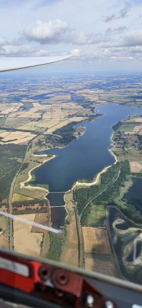
On 3rd July I flew my first 300Km task. Here’s how I did it. The thermals were high, strong, all day long and over all of the country, as predicted. So I set a task, bumbled into lift, climbed as high as I could and set back off on track, looking for the next lift – rinse and repeat until the finish line. The End. If you want a more scientific analysis of this witchcraft, please seek out someone who can actually explain it to you.
Today’s sermon, however, is not about the airborne part of the flight, but the groundwork around it, which transpired as the fundamental difference between a normal cross-country flight and a badge claim.
WhatsApp users will be aware ad nauseam of my egocentric and chaotic paranoia over task selection, such was my fear of tripping up my intended Gold Distance & Diamond Goal badge claim. The meticulous planning of the task (GRL, Garboldisham, Bottesford, GRL), analysing the weather, spyglass examination of the fragile badge claim rules, airspace and NOTAM research, en route radio frequency lists, Mildenhall’s special MATZ check-in points, declaration entry in my Oudie, joining a retrieve crew, sourcing an OO, etc. all ate up the prior evening.
Mike Tyson once said “everyone has a plan until they get punched in the mouth”. I was rigged, gridded and ready to go by about 10:30am. As I was sat in the clubhouse poring once more over my notes and route map, and double-checking the task in the Oudie, I rehearsed over and over how I would turn Mildenhall; the danger zone to the east was activated that morning up to 7500ft, meaning I had to sneak past via Thetford and Brandon, but then the rest of the task was clear. I had a plan.
Then Martin Whitehead came over and punched me in the mouth. He took one look at my task and politely proposed the subtlest of task tweaks that I’d just not considered, to avoid turning the Mildenhall MATZ altogether – turn at Newmarket instead. This shortened the task, so Newport Pagnall was added, which allowed me to shorten the top slightly to Newark. So the “new” task of Newmarket, Newark, Newport Pagnall it was. Martin and MLJ clarified another point I’d not fully understood – you can still call it a triangle even if it has three points plus GRL somewhere roughly in the middle of a leg, as long as those three points alone created a closed triangle over 300Km long. And given Newport Pagnall to Newmarket tracks directly over GRL, there was minimum wasted task length. This task avoided all practical airspace restrictions apart from a little wiggle around the Chatteris drop zone, there were only a few radio calls required, and the home leg was a short downwind dash bent north just under Bedford. It could not be simpler or cleaner, and should absolutely be a pre-declared club task.
So I had a new task. Next I needed to update the Oudie accordingly. Here are some badge claim gotchas. The FAI turnpoints have a 0.5km barrel, but I’m not falling for that – I’ll fly fully round, thanks! start and finish lines are famously 1km long, but be careful here; you need to enter a radius of 0.5km into the Oudie to get that 1km line (entering a 1km radius gives you a claim-busting 2km line). And of course, airspace must be avoided en-route. Then there’s the potential height loss rule – you must reduce your completed task distance if you finish more than 1000m below your start altitude. Again, just make sure you cross the finish near to the same height that you started and you’re fine, even if that means holding short of the finish line to top up.
The bureaucratic effort continued after the flight. Find an OO, hand them the trace, check it for completion and airspace violations (e.g. the Cambridge RMZ incorrectly shows up as a Class D violation in SeeYou), analyse the trace in IGC Viewer, print out the claim form, fill it in, get it signed, and finally email the IGC file and scanned form to Luke “Sky” Walker at BGA, whom I guess was inundated that day. And it didn’t stop there for me, as I constantly jumped at shadows as I repeatedly over-analysed the trace for a day or two after, looking for possible ways the claim could be voided (again, apologies all for my WhatsApp panic!).
So the moral of the story is this. Normal cross country races are won and lost between cloudbase and half cloudbase, but a badge claim is definitely won or lost at an altitude of 254ft.
They say it takes a village to raise an idiot, and I could not have completed this task without everyone who willingly gave their expertise, support, encouragement and tolerance to get me over the line. Thank you all so much.